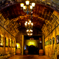
Wine enthusiasts will no longer have to trust in oft-unreliable map apps to navigate among the South County’s 20-plus wineries—some of which are tucked deep into the folds of rural hillsides—after county officials approved a new sign program directing motorists to the viticultural destinations.
Earlier this month, the Santa Clara County Board of Supervisors voted unanimously to adopt the Santa Clara Valley Wine Trail Route and approved a wayfinding signage program that clears the way for installation of directional signs that will guide motorists to South County wineries.
Santa Clara County’s wine trail signage will combine with efforts by the cities of Morgan Hill and Gilroy to direct oenophiles to wine facilities within their respective city limits, according to county staff. Signs in unincorporated county areas—featuring the logo of the Wineries of Santa Clara Valley association—will be installed by the end of summer 2014, organizers said.
Wine association members brainstormed the wine trail idea more than a year ago and will pay for the installation and maintenance of any replacement or new signs needed along the SCV Wine Trail route in the future.
The county’s adoption of an official wine trail for Santa Clara Valley is “fabulous,” said Greg Richtarek, Guglielmo Winery’s marketing director and President of the WSCV association.
“It’s good that somebody’s paying attention,” Richtarek said.
Wine trail signage will guide motorists in a circle through South County, along Watsonville Road, Hecker Pass Highway and the east sides of Gilroy, San Martin and Morgan Hill. Branches off the main trail will direct vehicles to more remote wineries, and signs reminding motorists “Don’t Drink and Drive” will be installed and key locations along the route.
In the future, county officials said they plan to link the trail to wineries in the northern and western parts of Santa Clara and Santa Cruz mountains to create an even larger wine loop.
 Foster the People, M.I.A., Fitz and the Tantrums to Headline BFD 2014 Lineup
  Mountain Winery Summer Concert Lineup Features 90s Throwbacks, Classic Rockers